[vc_row][vc_column][vc_column_text css=”.vc_custom_1712669053455{margin-bottom: 0px !important;}”]
The Technology Dimension
In a way, on reflection, as a team of university staff working with these teachers, we noticed we too had to be concerned with these same task types. Ahead of the first project gathering we needed to learn about the best type of GPS to purchase and how it worked (whilst keeping in mind our other goals). In use, teachers fed back more about what kinds of technology worked best and how it might get used in a class setting indoors and outside.[/vc_column_text][/vc_column][/vc_row][vc_row][vc_column width=”1/2″][vc_column_text css=”.vc_custom_1712669142196{margin-bottom: 0px !important;}”]
Considerations regarding choice and use of GPS technology in primary school settings
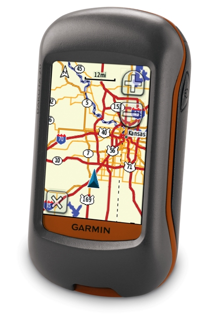
We bought 10 Garmin Dakota 20 for the project. We cam to this decision through researching what technology was available, what young people of primary age might find useful, and what our project requirements were.
We allowed for a period when teachers would become familiar with one of these through personal use and use with classes. As the project progressed, we created a store of these units on campus for teachers to loan out (3,5, or more at a time).
Buying and use of GPS – issues arising
Technology is changing quickly. Not much information on what is best to buy for this age group. Initial decision to buy GPS (rather than get apps for smart phones) was down to requirements for:
• Robustness
• Focused on task required – big screen, touch screen
• No other distracting technology (not a phone!)
• Ease of use and set up for multiple use
When considering which GPS to get we first tried a cheaper traditional version – however this was more complex to use, technical (not user-friendly), required the use of separate paper maps and additional paper notes. We therefore decided to purchase Garmin DAKOTA 20. – This is because these GPSs had:
• Robustness (often dropped/left behind/get wet)
• Screen based technology (pupils are used to this – more intuitive)
• Use of icons – pupils are used to this – more intuitive
• Cheap base maps available
• Can download hints and notes on individual geocaches (with a premium account)
• Could take rechargeable batteries
• Geocache files can be sorted via computer
Other advantages (after use) were –
• GPS – could send information wirelessly among units
• Could save official geocaches and also waypoints (latter useful if you do not want to upload your caches to a public website)
• Can customise – number of different settings can be changed to suit context/environment
• Can include notes/photos
• Can include SIM cards
Disadvantages
• Costs – GPSs are not cheap compared with other technologies
• Batteries run out quickly
• Relatively limited functionality – Other technologies could potentially integrate sound and film
• Takes practice to get use to functions/toggle between modes/pages etc
• Screen can sometimes be difficult to see in the sunlight
• Instructions are generic and only for basic use – are not specifically geared to geocaching. Had to do a lot of web based searching for more advanced functions
• Cannot sort/delete geocaches on the go (as far as I am aware – need to do this on a computer)[/vc_column_text][/vc_column][vc_column width=”1/2″][vc_column_text css=”.vc_custom_1712669162681{margin-bottom: 0px !important;}”]
Practical issues emerging from GPS use
• Does a school or a class have a single geocache account – or should this be at individual level?
• If using for full geocaching experience, it is better to set up a premier account (costs involved are small for one person however). You need an e-mail address to set up an account – this raises issues for children perhaps. One adult account is possibly the simplest for a class to go geocaching. There are potential issues with children being involved in an on-line community – we have considered these. In practice, if a teacher logs onto geocaching.com they have control over pupil interactions on line.
• Any system for booking in/out technology like this needs to be managed.
• Given costs involved – should schools continue (after the project ends) to share GPS – there would be then need to consider practicalities.
• Communication with parents/carers – the links with parental involvement is interesting. Families go geocaching all the time.
• System for ensuring batteries re charged
• Default settings – we are looking at how these get used when technology gets returned. Management of files on the GPs if they are used at different times by different groups.
• Do we need a system for identifying files/geocaches/waypoints of different users
• Use of GPS outdoor brings additional health and safety issues (particularly around looking at GPS and avoiding hazards/geocaches near water etc). We have addressed these as they arose.
• Use of GPS and geocaching etiquette. We have been learning these rules.
• Use of GPS and group dynamics need to be considered. We have devised some approaches
• for group geocaching and for not spoiling the fun of finding the cache.
[/vc_column_text][/vc_column][/vc_row]